 USD
USD
 EUR
EUR
 TRY
TRY
 SAR
SAR
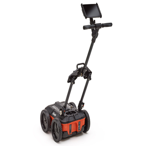

COMPACT GPR SYSTEM FOR UTILITY LOCATING
Brand: GPR Systems - GSSI'S
Categories: Ground Penetrating Radar Systems (GPR Systems) | Metal Detectors
Detection Systems: Archaeological Treasures Detectors | Devices with Multiple Systems
+90 (216) 415 56 86
₹ 2,600,000.00
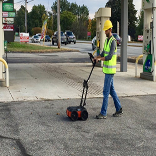
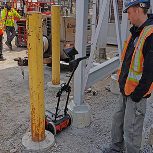
Buy NowUtility locators, construction professionals, environmental firms and land surveyors need to know about underground assets prior to digging and trenching efforts. Learn more about how our ground penetrating radar (GPR) utility systems help locate and map metallic and non-metallic underground utilities and subsurface characteristics.
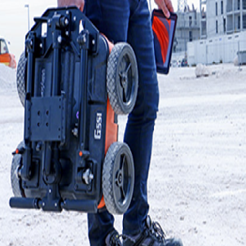
The UtilityScan features a wireless and lightweight configuration, our patented HyperStacking technology for unparalleled data quality, and integrated LineTrac system. This state-of-the-art system sets the new standard in performance and price.

Locate and Map Underground Utilities
Contractors can mark out the depth and position of metallic and non-metallic pipes, and continuous plastic conduits such as gas and water lines, in real time using the GSSI UtilityScan products. GPR can enhance the overall understanding of subsurface targets and obstructions.
Taken at the GSSI utility test pit, this data illustrates 3 utility targets at various depths. These targets are metal, and this data was taken with the SIR 4000 and 400 MHz antenna. This data image highlights the marker input feature in the SIR 4000 control unit.

Locate Utilities with LineTrac
This data image was taken with the new UtilityScan and shows a target at 1m deep, target is electric utility with 60 Hz power detected. This data set highlights the LineTrac feature that is optional in the UtilityScan system.

Locate Duct Banks
Utilities encased in concrete and groupings of utilities can be located by using ground penetrating radar.
This 2D data set shows a duct bank with five utilities. Also shown is a well-defined excavation trench. This data was collected with the UtilityScan Pro with the 400 MHz antenna.

Identify Underground Voids
Construction professionals, engineers and transportation departments can identify and delineate voids under the surface of concrete and asphalt roadways with ground penetrating radar.
Data illustrates a well defined void underneath a reinforced concrete slab with an asphalt overlay. Note the small subsurface utilities in the bottom right of the data set. This data was taken with a SIR 4000 and 900 MHz antenna.

Geolitix: Utility Locating & Mapping
These data were collected down the street from the GSSI facility with the objective of mapping utilities. Data were collected with a UtilityScan system using GS Software in combination with an Emlid Reach GNSS receiver with NTRIP corrections.
A “random-walk” looping pattern was employed to collect the data. This method drastically cut down on data collection time vs. the more traditional gridding method.
Data was brought into Geolitix where it was sliced using the easy “Suggest parameters” tool.

Geolitix: Utility Locating & Mapping
Obvious utilities were interpreted in 3D space and classified based on in-field context clues. Interpretations can be exported in various formats, or a Public Link can be created to share the interactive 3D project directly with clients.
This entire process, from field collection to a shareable 3D model, demonstrates a highly efficient workflow for modern utility locating and damage prevention.
MAX DEPTH - 10 m (35 ft)
- ANTENNA FREQUENCY - 350 MHz
- WEIGHT - 15.4 kg (34 lbs)
- STORAGE CAPACITY - 64 GB
- OPTIONAL SOFTWARE - RADAN 7 for UtilityScan, RADAN 7
ACCESSORIES
- Transit case, Battery booster kit, Sunshade, Model 656 rugged cart
- The UtilityScan is typically used to:
- Scan utilities - metallic and non-metallic
- Locate water lines
- Detect voids and underground storage tanks (USTs)
- Identify soil and foundation characteristics
- Locate shallow objects for archaeology
- 350 HS antenna (350 MHz)
- Choice of control unit with system mount:
- Customized Panasonic Toughpad (R) FZ-A2 or, NVIDIA SHIELD Tablet
- Lithium-ion battery (2)
- Dual-bay battery charger
- Rugged 2 m ethernet cable
- LineTrac, optional
- Sunshade for Panasonic A2
- Quick Start Guide
- 2-year warranty
- DISPLAY - 7" or 10" (tablet dependent)
- ENVIRONMENTAL RATING - IP65 (tablet dependent)
- DISPLAY MODES - Linescan and Focus Mode
- AVAILABLE PORTS - USB 3.0, Micro USB
- DATA COLLECTION SPEED - < 3.5 mph (6.5 km/h)
- OPERATING TEMPERATURE - -20°C to 40°C (-4°F to 104°F)